|
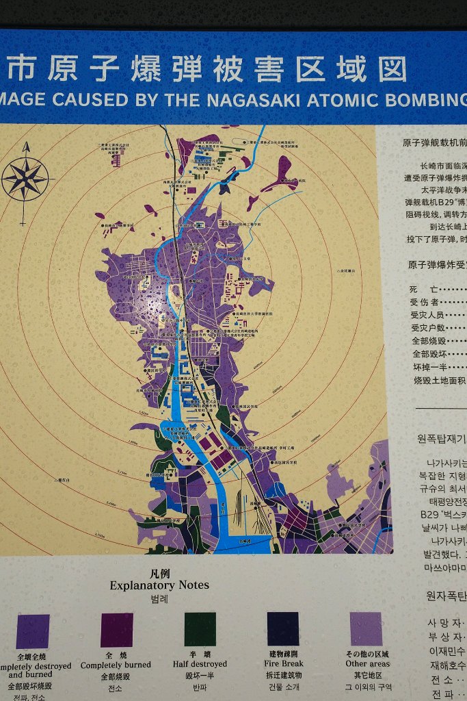 |
| 14-Map of damage caused by atomic bomb | |
| Latitude: N 32°46'24,39" | Longitude: E 129°51'47,56" | Location: Urakamimachi | City: Matsuyamamachi | State/Province: Nagasakiken | Country: Japan | See map | |
| Total images: 23 | Help | |
|
|
|
| 14-Map of damage caused by atomic bomb | |
| Latitude: N 32°46'24,39" | Longitude: E 129°51'47,56" | Location: Urakamimachi | City: Matsuyamamachi | State/Province: Nagasakiken | Country: Japan | See map | |
| Total images: 23 | Help | |